The Victoria Falls
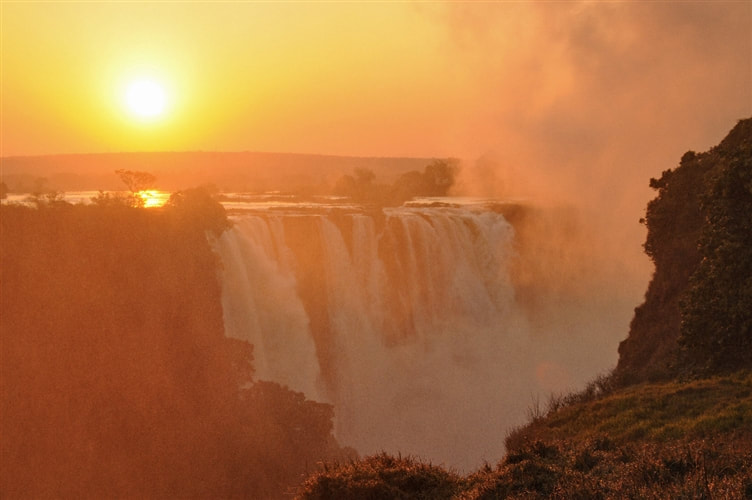
Mosi-oa-Tunya, the local name for Victoria Falls, on the Zambezi River, is certainly a far more descriptive name for the actual waterfall. The Smoke That Thunders is the translation – and a highly accurate one!
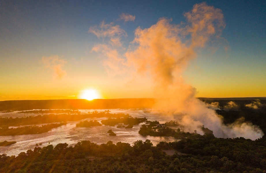
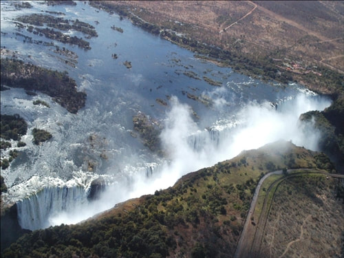
During March and April when the volume of water going over the Falls is at its greatest, you are hard pressed to hold a conversation above the sound of the water, and even if there isn’t a cloud in the sky, be prepared to get a soaking… rain coats and umbrellas are on hand, and don’t be embarrassed about using them!
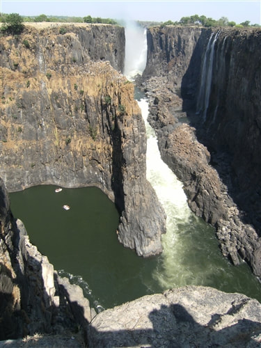
Of course the level of the Zambezi River changes with the seasons… and during November and December, the waters are at their lowest, thus turning the spectacle into a trickle, and making for some interesting geology! Even ‘off season’ the Falls are fascinating, you get to see the true extent, and on the Zambian side in particular, you can actually walk, and even swim, not to mention picnic, at the top of the Falls.
Therefore, if a visit to the Falls at Victoria Falls is on your 'bucket-list' you may want to check to ensure that the water flow will be at it's best for the time of year in which you wish to travel. Although weather is somewhat unpredictable, the seasons are generally set regarding rainfall, water levels.
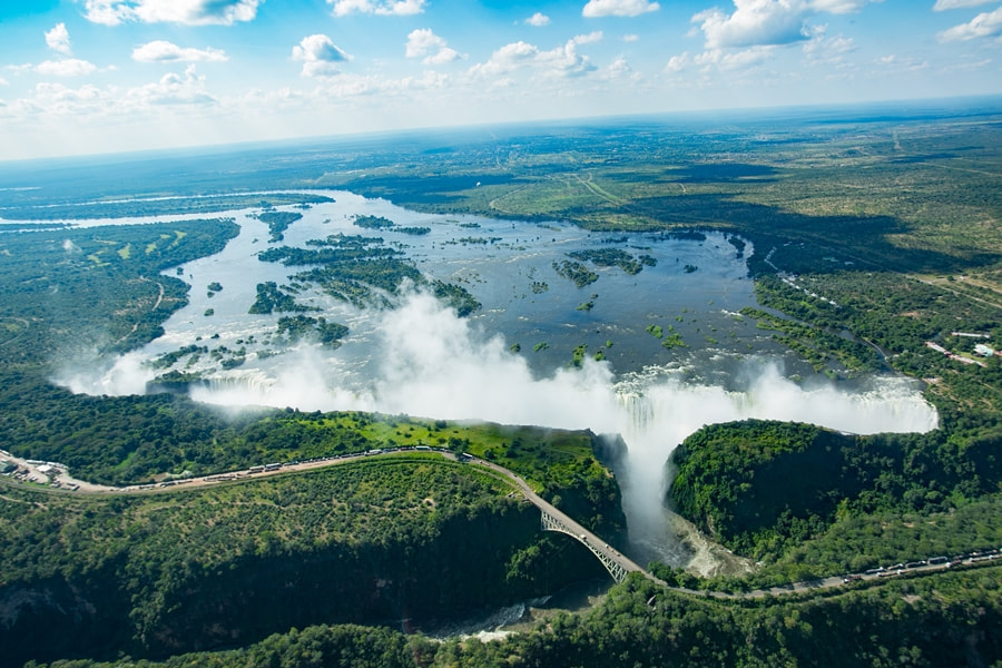
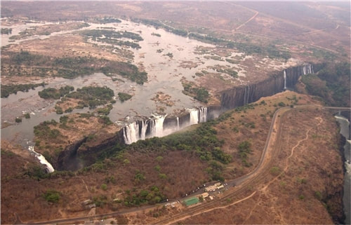
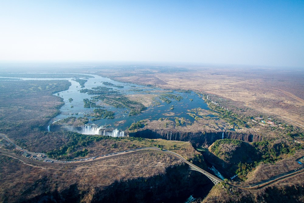
A true description wouldn’t be complete without just a few numbers: at peak flow, an estimated 546 million cubic metres of water per minute cascade down the 100 metre high falls, with the waters spreading over the 1.7 kilometre long edge. The River then disappears into a series of dramatic, and narrow, gorges.
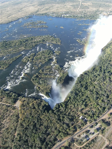
Our images below give you some idea of water levels in conditions, throughout the year, on both the Victoria Falls and Livingstone sides of the Zambezi River, as it plunges down the Falls.
During March and April when the volume of water going over the Falls is at its greatest, you are hard pressed to hold a conversation above the sound of the water, and even if there isn’t a cloud in the sky, be prepared to get a soaking… rain coats and umbrellas are on hand, and don’t be embarrassed about using them!
Of course the level of the Zambezi River changes with the seasons… and during November and December, the waters are at their lowest, thus turning the spectacle into a trickle, and making for some interesting geology! Even ‘off season’ the Falls are fascinating, you get to see the true extent, and on the Zambian side in particular, you can actually walk, and even swim, not to mention picnic, at the top of the Falls.
Therefore, if a visit to the Falls at Victoria Falls is on your 'bucket-list' you may want to check to ensure that the water flow will be at it's best for the time of year in which you wish to travel. Although weather is somewhat unpredictable, the seasons are generally set regarding rainfall, water levels.
A true description wouldn’t be complete without just a few numbers: at peak flow, an estimated 546 million cubic metres of water per minute cascade down the 100 metre high falls, with the waters spreading over the 1.7 kilometre long edge. The River then disappears into a series of dramatic, and narrow, gorges.
Our images below give you some idea of water levels in conditions, throughout the year, on both the Victoria Falls and Livingstone sides of the Zambezi River, as it plunges down the Falls.